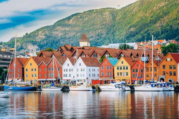
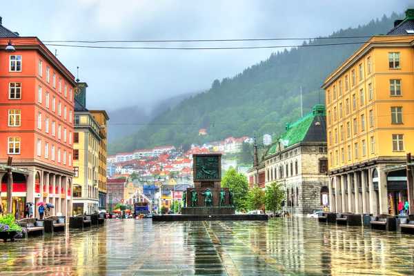
Bergen is known as the city among the mountains and of course has plenty of great hiking terrain. Many forests and mountains close to the city are well adapted for families with children, joggers and also for the slightly less active who just need some fresh air. But there are also some really challenging routes with windy peaks that require a certain level of physical fitness, equipment and mountain weather.
If you want to start slowly, start with short walks and barbecued sausages in the forest area. And once you've got a taste for the outdoor life, you can then go on to tackle some of the many peaks and long hiking trails the area has to offer.
- 1
Sofusstien
Pleasant Hike from Vinddalen to Stangelifjellet

- Adventure
Sofusstien is a short, steep path from Vinddalen opposite Jordalen in Eidsvåg up to Stangelifjellet. It is named after the terrier Sofus, who broke a foot here when it chased a deer. Local hiking enthusiasts cleared the deer trail, so that it is now a passable path that has become a popular route up the ridge north of Jordalen.
The mountain narrows further up and peaks such as Stangelifjellet and Ulskebjørnen have a great view of Eidsvåg. This is breezy hiking terrain with several route choices to vary the return trip. If you take in Vinddalen on your hike and walk the steep path down from Ulskebjørnen, you can visit the pretty little Stallane farm, which is idyllically located up in the hill.
Location: Vinddalsveien, 5106 Bergen, Norway
Map - 2
Fjellveien
Stroll in the Mountains

- Families
Fjellveien is a wide and well-built road that stretches just under 5 kilometres from Munkebotn north of Bergen city centre to Bellevue south of the city centre. Parts of the road are paved and surrounded by buildings, and even the greenest, gravel-covered central part is so well-made that you won't need hiking boots. Add in that the height difference is minimal, and you realise that this is more of a promenade than a hiking trail.
Such a central and well-organised walking route is of course popular, so expect to share your walk with the crowds on Sundays. If you prefer a little more elbow room and a more demanding hiking terrain, just take one of the detours up towards Fløyen.
Location: Fjellveien, Bergen, Norway
Mapphoto by Cavernia (CC BY-SA 3.0) modified
- 3
The 7 Mountains
All the City Mountains in One

- Adventure
This 7-mountain hike is a traditional test of strength for hikers in the Bergen area. It has been taking place every year since 1948, on the last Sunday in May. The route has changed over the years, but since the early 1980s it has started with Lyderhorn and then Damsgårdsfjellet, Løvstakken, Ulriken, Fløyen, Rundemanen and Sandviksfjellet.
The trip is about 35 kilometres long and has a total ascent of 2200 metres. The fastest do it in less than three hours, but ordinary mortals should expect to take at least eight hours. You can of course also do the trail outside the official event, and you will find a detailed description on it at ut.no.
Location: (Starting point) Gravdalsveien 245, 5165 Laksevåg, Norway
Map - 4
Løvstien
A Hike for the Whole Family Under Løvstakken

- Families
Løvstien is a relatively new hiking trail along the city side of Løvstakken in Bergen. It is almost directly opposite Fjellveien, but on the other side of Bergen city centre. It stretches all the way from Melkeplassen in the north to Langegården in the south, and so helps facilitate access to a large hiking area.
The road is wide and gravelled, making it easy to walk with a pushchair or pram. And children will love the six so-called "nature rooms" that are laid out along the hiking trail, mainly in the northern part. This place benefits from several play areas with everything from ball games to play involving water and sand, climbing and sculptures.
Location: Løvstien, 5161 Laksevåg, Norway
Map - 5
Hordnesskogen
Popular Woodland Area in South Bergen

- Families
Hordnesskogen is a well-organised hiking area heavily frequented by people from Fana and Ytrebygda. Good gravel roads attract many families with children and dog walkers out with their furry friends. Fitness enthusiasts of all levels can enjoy the well-lit trails right up until eleven o'clock at night, plus the outdoor exercise equipment. Wheelchair users also find it easy to get around this trail network.
Good parking opportunities and marked trails attract people from outside the area. If the gravel roads get a bit too dull, the many off-track paths allow you to explore the forest further, and when hunger strikes, there are plenty of tables and benches to have your lunch at.
Location: Hordnesskogen, 5239 Bergen, Norway
Map - 6
Smøråsfjellet
Fun Trails for Kids

- Families
Smøråsfjellet is not particularly tall or wide, but for families and hikers in the area, it's a true gem. This is partly thanks to a volunteer group - Friends of Smøråsfjellet - who have cleared the forests with chain saws and other tools, made paths, built huts, carved sculptures and generally adapted the area to suit hikers - especially little ones.
When the weather turns bad, as it often does in Bergen, there are plenty of sheltered campfire areas to warm up in. The good gravel roads are suitable for little wheels, and many paths have small bridges over the worst bogs, so that you can venture into the forest without getting mud up your legs. You can hike through the entire area in an hour, but the kids are unlikely to be in a hurry.
Location: Nøttveitvegen 100, 5238 Rådal, Norway
Map - 7
Kanadaskogen
Large Forest in the Western District

- Families
Kanadaskogen (the Canada Forest) is the forest area between the western districts of Laksevåg, Loddefjord and Fyllingsdalen. The area consists of a busy and child-friendly part around the bathing area at Tennebekktjørna, as well as hillier forest terrain in the direction of Damsgårdsfjellet. Thanks to the municipallity and some enterprising volunteers, this area has been perfectly prepared for hikers.
Many visitors park in Nipedalen, close to a bathing area with toilet facilities, a diving platform and artificial sandy beaches. In summer, the water quickly gets hot, and canoe rental is popular. The hiking trail around Tennebekktjørna is wide and gravelly, but you will find wilder nature if you walk up the bend on the east side of the water, where Viggohytten is an attractive hiking destination with views and ice cream and drinks on Sundays.
Location: Kanadaskogen, 5145 Bergen, Norway
Map - 8
Gullfjellet
Top Hike to the Highest Point in Bergen Municipality

- Adventure
At 987 metres high, Gullfjellet is the highest mountain peak in Bergen municipality and a classic for hikers - especially in winter on a set of skis. It is located in the area that connects the Bergen Peninsula with the hinterland, the most remote place in the municipality with stunning views, but also temperamental and foggy weather.
A popular route from Bergenssiden goes from Osavatnet via Redningshytten and the hill Korketrekkeren along the cairn ridge to the top. A shorter summer route on this side makes for a perfect round trip. On the east side there is a popular route from Gullbotn tourist centre, where you are also guided by a cairn. And for a really long trip, start at Nesttun, follow the cairns from Totland to Gullbotn, and take the train to the city from Trengereid.
Location: (Osavatnet parking) Gullfjellsvegen, 5268 Haukeland, Norway
Mapphoto by trolvag (CC BY-SA 3.0) modified
- 9
The Mountains of Bergen
The Mountains that gave Bergen its Name

- Adventure
- Families
- Photo
Bergen's original name Bjørgvin means "the green plain among the mountains", and the city coat of arms shows seven round peaks that symbolise the city's surrounding mountains. There has been some disagreement about which mountains make up the seven, but according to the route for the 7-mountain-hike these are Lyderhorn, Damsgårdsfjell and Løvstakken in the west, and Ulriken, Rundemanen, Fløyen and Sandviksfjellet in the central mountain ridge.
Most of them are within walking distance of the city centre, and Fløyen and Ulriken have a cable car and a gondola lift, which take you effortlessly to the top. The highest is Ulriken with an altitude of 643 metres, which is easier to walk now that Sherpas from Nepal have built steps on large parts of the road. The trip across the plateau between Ulriken and Fløyen is a great classic.
Location: Bergen, Norway
- 10
Damgårdsfjellet
The Most Modest of Bergen's Seven City Mountains

- Adventure
With a height of just 317 metres and no distinctive peak, Damsgårdsfjellet is the least noticed of the seven mountains around Bergen. It is still very popular hiking terrain with its many trails, so many in fact that it can be a little confusing, so it's worth knowing your bearings before you set off here.
A popular route is from the bathing area at Tennebekktjørna in Nipedalen. This route rises steeply up to Nipetjørn and Gravdalsfjellet with signs east to Damsgårdsfjellet. From the eastern side there is a signposted path from Melkeplassen, which is as steep as from the other side. The top of Damsgårdsfjellet is actually lower than several of the neighbouring peaks, but because it is located at the back, it has a privileged view of the entrance to Bergen.
Location: Damsgårdsfjellet, Bergen, Norway
Map


